Drawn Against Erasure: The Eastern European Cartographers Who Mapped Worlds on the Brink of Disappearance
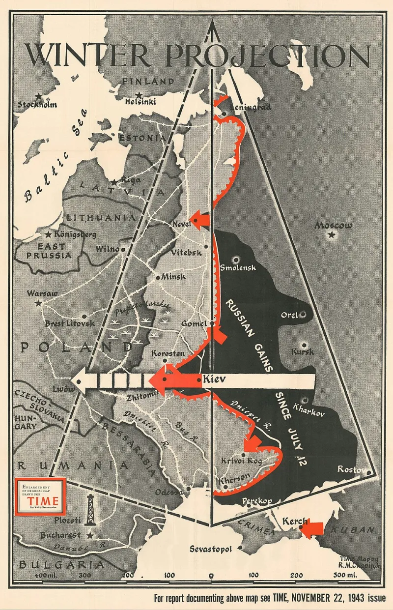
Photo: M. Chapin, Jr., Public domain, via Wikimedia Commons
A map is never simply a technical document. In the hands of an imperial administration, it is an instrument of control—a declaration of what exists, what has been renamed, and what has been made officially invisible. Yet the history of Eastern Europe offers a countervailing tradition: cartographers who understood this dynamic and responded to it with painstaking, deliberate documentation. Their work constitutes one of the most consequential forms of scholarly resistance in the modern historical record, and much of it is preserved today not in Warsaw or Lviv or Vilnius, but in university archives and special collections across the United States.
The Map as an Act of Memory
The impulse to document what political authority sought to suppress runs deep in Eastern European intellectual culture. During the partitions of Poland in the late eighteenth century, cartographers affiliated with the Commission on National Education—one of the earliest state education ministries in the world—produced detailed surveys of Polish-speaking territories even as those territories were being formally absorbed into Russian, Prussian, and Austrian administrative frameworks. These maps recorded not merely topography but linguistic boundaries, parish networks, market towns, and the names of villages as their inhabitants actually used them, rather than as the new imperial overlords preferred to designate them.
This distinction between the cartographer's name and the administrator's name is not a trivial one. When imperial authorities imposed new toponyms on conquered regions, they were doing more than renaming streets. They were asserting that the previous name—and by extension, the community that had used it—was a historical error to be corrected. The Polish, Ukrainian, and Lithuanian cartographers who continued to record indigenous place names were making an explicit counter-argument: that these communities possessed a geographic reality that no administrative decree could annul.
Galicia and the Art of Scholarly Subversion
The region historically known as Galicia—spanning portions of present-day southern Poland and western Ukraine—produced an especially rich cartographic tradition during the nineteenth and early twentieth centuries. Operating under Austro-Hungarian administration, scholars at the University of Lwów (now Lviv) enjoyed a degree of academic latitude that their counterparts in Russian-controlled territories did not, and they exploited that latitude with considerable ingenuity.
The geographer Eugeniusz Romer, working in the early decades of the twentieth century, produced a series of ethnographic atlases that charted the distribution of linguistic and religious communities across the region with extraordinary precision. Romer's methodology was self-consciously political: he recognized that statistical and cartographic evidence could serve as a form of advocacy in international forums where the fate of disputed territories would eventually be decided. His atlases were consulted by delegates at the Paris Peace Conference in 1919, and portions of his archive ultimately found their way into American collections following the upheavals of the Second World War.
Romer's case illustrates a broader pattern. Scholarly cartography in Eastern Europe was rarely a politically neutral enterprise. The question of which communities occupied which territories—and how long they had done so—carried enormous consequences for populations whose national survival depended on international recognition.
Smuggled Across Borders, Preserved in American Stacks
The fate of Eastern European cartographic collections during and after the Second World War is a story of extraordinary loss punctuated by equally extraordinary acts of preservation. As German and Soviet forces swept through the region, many of the most significant geographic archives were deliberately targeted for destruction or confiscation. Soviet authorities were particularly systematic in their efforts to suppress cartographic evidence of Ukrainian, Baltic, and Belarusian national distinctiveness.
In response, scholars and archivists employed methods that would not look out of place in an espionage narrative. Maps were rolled into document tubes and hidden beneath floorboards. Atlases were dismantled and their pages distributed among multiple couriers. Microfilm copies were produced clandestinely and carried westward by refugees and displaced academics. A significant portion of this material eventually reached the United States, where émigré scholarly communities—concentrated in cities such as New York, Chicago, and Philadelphia—worked to catalog and preserve it.
American research universities, particularly those with strong Slavic studies programs, became repositories for collections that might otherwise have been lost entirely. The Library of Congress, Harvard's Map Collection, and the libraries of several major state universities now hold Eastern European cartographic materials whose significance is only beginning to be fully appreciated by contemporary researchers.
What the Maps Reveal
The scholarly value of these collections extends well beyond their historical interest. For researchers studying questions of ethnic cleansing, forced population transfer, and cultural erasure, detailed pre-war maps of Eastern European communities provide evidence that no other source type can replicate. They document the precise locations of Jewish shtetls, Greek Catholic parishes, Ruthenian-speaking villages, and German-speaking enclaves—communities that were either destroyed or forcibly relocated during the mid-twentieth century and whose former presence is otherwise difficult to establish with geographic specificity.
Digital humanities projects at several American institutions have begun the work of georeferencing these historical maps, overlaying them onto contemporary satellite imagery to reveal the full extent of demographic transformation across the region. The results are frequently startling. Entire urban neighborhoods that appear on 1930s maps as densely populated, culturally distinct communities show up on postwar surveys as blank administrative units, their former character erased as thoroughly as if it had never existed.
For the descendants of displaced Eastern European communities living in the United States, these maps carry a personal weight that no academic description can fully capture. They are, in many cases, the only surviving visual evidence of the worlds their grandparents and great-grandparents inhabited.
Cartography as Testimony
The tradition these mapmakers established has not entirely disappeared. Contemporary scholars working in the region continue to grapple with the political dimensions of geographic representation, particularly in areas where territorial disputes remain unresolved or where the demographic consequences of twentieth-century violence are still being documented. The methodological questions they raised—about whose names belong on a map, whose communities merit documentation, and who has the authority to define geographic reality—remain as urgent now as they were in the age of imperial partition.
For American scholars of Eastern European heritage and history, the cartographic archive represents one of the most underexplored resources in the field. As digitization projects continue to expand access to these materials, and as interdisciplinary methods increasingly connect geographic data with demographic, linguistic, and cultural analysis, the maps drawn by scholars who refused to accept erasure are finally beginning to receive the scholarly attention they deserve. They remind us that documentation, pursued with sufficient rigor and courage, can constitute a form of resistance that outlasts even the most determined efforts at suppression.